

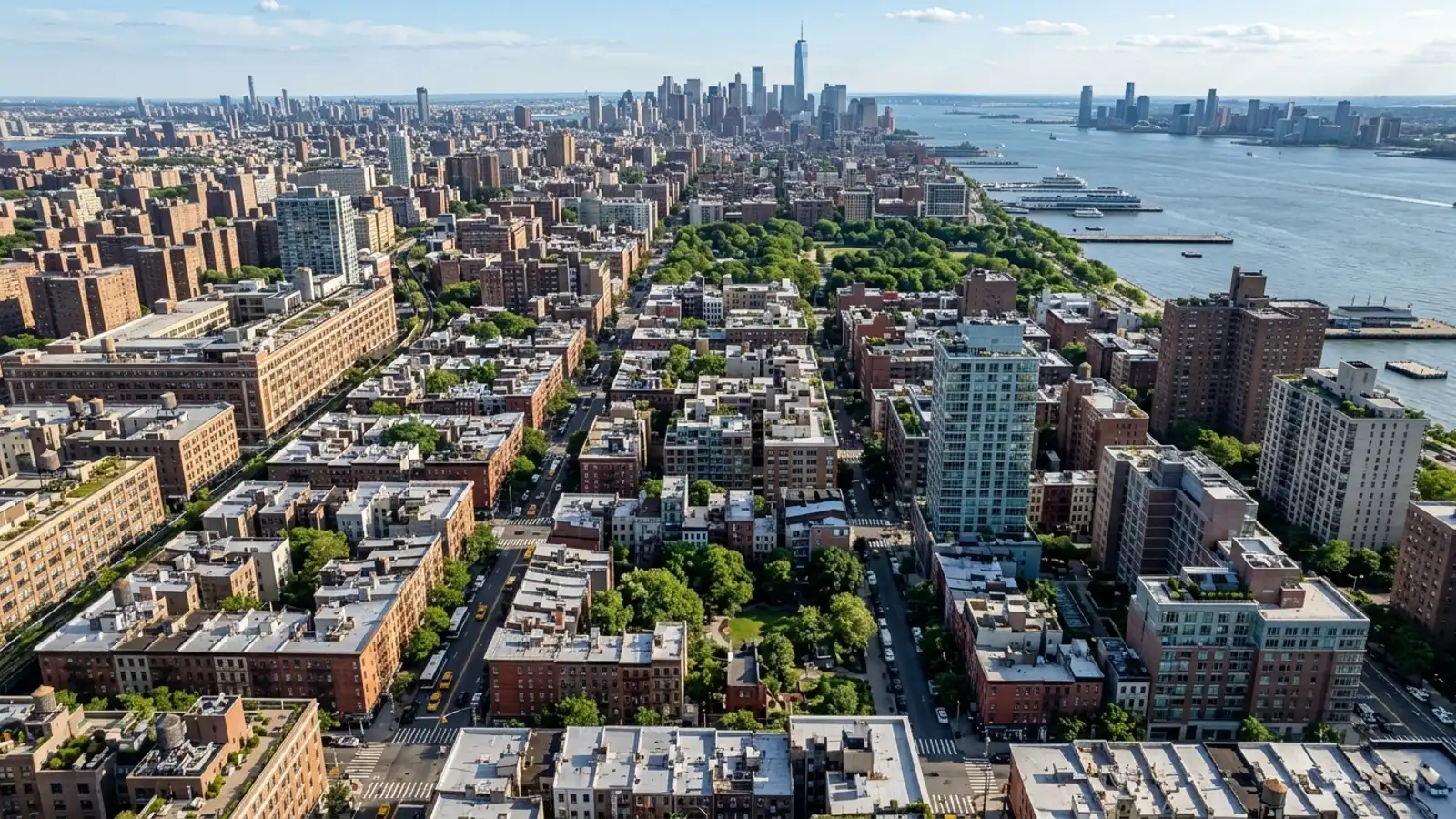
The median home price in Manhattan, NY sits around $1,450,000, and that number tends to focus buyers’ minds on a specific part of the pros and cons of living in Manhattan: what does getting around actually look like day to day? With roughly 5,715 homes on the market at any given moment, the right apartment often comes down to which subway lines are nearby, how close the bus stop is, or whether you’re willing to deal with a bridge toll every morning.
The borough’s infrastructure is layered – subways, ferries, buses, and a web of tolled crossings – and understanding how those pieces connect will save you real time, not just planning headaches.
Arriving in Manhattan, NY
Eight bridges and tunnels lead into the Congestion Relief Zone below 60th Street, which took effect in January 2025. That list includes the Ed Koch-Queensboro, Williamsburg, Manhattan, and Brooklyn Bridges, plus the Hugh Carey, Queens-Midtown, Lincoln, and Holland Tunnels. The MTA Bridges and Tunnels Authority and the Port Authority operate these major crossings. Further north, the Harlem River bridges connecting the Bronx and Manhattan stay untolled because they sit outside the congestion zone – though the Robert F. Kennedy (Triborough) Bridge requires a toll.
Driving Routes, Bridges, and Tunnels
Coming in from New Jersey, you’re looking at the Lincoln or Holland Tunnels, or the George Washington Bridge if you’re further uptown. From Brooklyn or Queens, the East River crossings are your options. If you plan to commute by car, build those tolls into your monthly budget now – the 2025 congestion pricing rules changed the calculus for a lot of drivers. Vehicles entering the zone below 60th Street face additional charges, and many commuters have responded by parking before the river and switching to public transit to avoid the fees entirely.
Nearest Airports and Gateway Transfers (JFK, LGA, EWR)
The three commercial airports serving the area are John F. Kennedy International (JFK), LaGuardia (LGA), and Newark Liberty International (EWR). JFK sits in Queens and is the main international gateway; travelers typically use the AirTrain to connect to the subway or LIRR. LaGuardia is closer geographically to the borough, while Newark is across the Hudson in New Jersey. All three offer taxi stands, ride-share pickup zones, and public transit connections into the city.
Driving Directions and Commute Times
Parking inside the borough is genuinely difficult, and there’s no single official park-and-ride system within Manhattan itself – commuter lots are extremely limited. The standard workaround is to park in New Jersey or the outer boroughs and take a train in. Commuters regularly use Long Island Rail Road (LIRR) and Metro-North lots in the suburbs, and places like Rosedale in Queens, to avoid both the drive into the city center and the daily garage rates.
Reaching Downtown and the Financial District
Driving to downtown Manhattan from JFK depends on traffic on the Van Wyck Expressway and the Long Island Expressway. Once you hit the Queens-Midtown Tunnel or the Hugh Carey Tunnel, you’re already in the tolled zone feeding the lower half of the island. These routes get congested fast during peak hours.
If you’re looking at property in the Financial District, do yourself a favor and test that drive on a Tuesday morning, not a Sunday. A trip that takes 45 minutes on a quiet weekend can push past an hour and a half on a weekday afternoon. Know what you’re signing up for before you sign anything.
Park-and-Ride Locations Outside the City
For commuters coming from the west, parking near NJ Transit or PATH stations is a practical move. Secaucus, Hoboken, Journal Square, Exchange Place, and Newport all have nearby parking facilities, and the PATH train connects directly into the city for a low fare, running nearly 24/7. The Port Imperial garages are another option – park there and take the NY Waterway Ferry across the Hudson. Compared to daily parking rates in the city center, the cost difference is significant.
Using Public Transit in the City
The base fare for subways, local buses, and Access-A-Ride in 2026 is $3.00, with a reduced fare of $1.50 for those who qualify. A Single Ride ticket runs $3.50, and the express bus base fare is $7.25. The MTA operates the whole network, and riders get unlimited free rides after paying for 12 trips within a rolling 7-day period – capped at $35 a week for base fare riders.
MTA Subways, Buses, and Ferries
The subway runs 24 hours a day and is how most residents move around. Local and express buses fill in the gaps, particularly for crosstown routes between subway lines. The two systems together mean almost every block is reachable without a car.
Ferries are worth mentioning separately – they’re useful for neighborhoods along the East River and the Hudson, and they offer a traffic-free commute to other boroughs or specific waterfront stops. Just know that the ferry requires a separate ticket from your standard MTA subway fare.
Current Fares and OMNY Passes
The traditional MetroCard is being phased out in favor of OMNY, the contactless payment system. You tap your smartphone, smartwatch, or contactless credit card at the turnstile and pay the $3.00 fare. The fare-capping feature is genuinely useful for frequent riders: once you hit your weekly cap, the system stops charging you for the rest of that seven-day period. Express bus riders have a higher cap of $67 per week; reduced-fare riders max out at $17.50 per week.
Living in Manhattan Without a Car
Homes in Manhattan take roughly 84 days to sell on average, and buyers tend to spend a good portion of that time walking the neighborhoods they’re considering. That instinct makes sense here – the dense grid and flat terrain make walking the default mode for handling daily errands.
Groceries, pharmacies, hardware stores – they’re typically within a few blocks of any residential building. For most people, that proximity alone eliminates the need for a personal vehicle.
Walkability and Daily Errands
Dedicated bike lanes have expanded across the avenues, and sidewalks handle serious pedestrian volume. You’ll see residents hauling groceries home in folding carts rather than loading up a trunk. The flat terrain makes walking several miles in a day less of a feat than it sounds.
Walkability does shift by neighborhood. Midtown and Times Square run dense and fast, while residential pockets further uptown or downtown tend toward quieter, tree-lined blocks. Either way, pedestrians take priority over vehicle traffic in how these areas are laid out and used.
Yellow Cabs and Local Ride Services
When walking or the subway isn’t practical, yellow taxis and rideshare vehicles are easy to find. You can hail a cab on almost any major avenue or pull up a car through a smartphone app in minutes, day or night. These services handle the edge cases – airport trips, moving large items, getting home late – without the ongoing costs of owning a car. No monthly garage fee, no insurance, no maintenance.
Booking Airport Shuttles and Transfers
Several companies run shared-ride and private shuttle services between Manhattan and the major regional airports. ETS Airport Shuttle has been serving JFK, LaGuardia, and Newark with shared and private vehicles since 1996. GO Airlink NYC is an official Port Authority licensee offering shared shuttles, private vans, and a Grand Central Express shuttle. New York Airport Service, operated by GO Airlink NYC, also runs a shuttle between Grand Central Terminal and LaGuardia or JFK.
Shuttle Services From JFK Airport
Shared shuttles sit in the middle ground between a subway fare and a private taxi. You book a seat in a van that makes multiple stops at hotels or residential addresses, which keeps individual ticket prices lower. Pickup is typically outside baggage claim. Travel times vary depending on how many stops the driver makes before yours, so build in extra time when you’re planning around a flight.
Private Vans and Chauffeured Rides
Blacklane provides private chauffeured transfers from all three major airports into the city. It’s the right call for business travelers or families with a lot of luggage who want a direct route without multiple stops. Book in advance – availability tightens during peak holiday travel – and the driver will meet you inside the terminal and handle the bags.
Specialized and Accessible Transportation
Project CART has offered free individual and group transportation for older adults in the borough for over 30 years. Funded by the NYC Department for the Aging, the service covers Manhattan Community Districts 1 through 8. Seniors can book rides for medical appointments and cultural events by calling 311 or through the city’s aging portal.
Senior Transportation Options
NYC Wheelchair Transportation and NYC Transportations both provide door-to-door senior and ambulette services across the borough and the wider metro area – doctor visits, surgery admissions, transfers to assisted-living facilities. Drivers are trained to assist passengers from the front door to the vehicle, and the vans are fully equipped with wheelchair lifts and securement systems.
Non-Emergency Medical Rides
For non-emergency medical transportation, private providers like RIDE A WAV offer wheelchair-accessible rides to hospitals and nursing homes, operating by appointment for individuals who can’t comfortably use standard taxis or rideshares. The vehicles accommodate various mobility devices, and booking well ahead of your appointment time is the practical move given city traffic.
Frequently Asked Questions
How much does proximity to a subway station affect property values in Manhattan?
It depends on the neighborhood, but buyers consistently prioritize homes near public transit. The median sale price in the borough is roughly $1,450,000, and a major factor in those valuations is the ability to commute easily via the MTA subway system. Homes near express stops tend to see the highest demand.
Is it worth owning a car when buying an apartment in Manhattan, NY?
Rarely. The MTA runs extensive 24-hour subway and bus service at a $3.00 base fare, and most residents get by with walking, public transit, or yellow cabs rather than paying for monthly parking and congestion tolls.
Which Manhattan neighborhoods offer the best public transit access for daily commuters?
It depends on where you need to travel, but areas near Midtown and Times Square give you access to multiple intersecting subway lines. The Port Authority Bus Terminal and Grand Central Terminal also serve as major hubs for reaching the outer boroughs and suburbs.
How much should I budget for monthly transportation and commuting costs living in Manhattan?
It depends on how often you ride, but the OMNY system caps local MTA fares at $35 per week. If you’re relying on the subway and local buses, you’re looking at roughly $140 a month. Express bus riders have a higher weekly cap of $67.
What are the best alternatives to the subway for getting crosstown in Manhattan?
Local MTA buses run on a $3.00 base fare and are the primary crosstown option. Yellow cabs and rideshare apps handle direct east-to-west trips as well. A lot of residents just walk – the grid layout makes crossing the island straightforward.
Are there any transit deserts in Manhattan that homebuyers should avoid?
No true transit deserts exist in the borough, though some far eastern or western avenues mean a longer walk to the nearest subway. In those spots, the MTA local bus network fills the gap and connects you to the subway stations.
Social Cookies
Social Cookies are used to enable you to share pages and content you find interesting throughout the website through third-party social networking or other websites (including, potentially for advertising purposes related to social networking).